Our plans today are to see the drawings, or rock art created hundreds of years ago on the ceiling of caves in the Dedza area of Malawi. The people who completed the drawings were lost to history and we want to see what they left behind. We have not been able to find any maps of their exact locations, so we have decided to simply drive to Dedza, stop there and ask directions to the caves.
Near the south edge of Dedza we make the left turn onto the dirt road and move toward the mountain peaks to the east. The center of the road is hardened from the traffic of old dilapidated logging trucks, while the edges are potted with unexpected ruts and abrupt drop offs. It is not unlike most unfinished roads that traverse the countryside away from the few tarmac highways. Torrential rains plummet the landscape from October to April, effectively ending the usefulness of many Malawi roads. The government has few resources to restore them to full usefulness when the dry season spreads out across the landscape.
Two black oxen, heads lowered, pull a weather-beaten cart slowly along the road. The young driver in an old worn brown shirt encourages them to the side of the road with a long stick. As the cart passes our vehicle we see a number of dust-covered white bags piled in the back, probably a village’s supply of maize to be ground into fine powder for nsima, the staple diet of every Malawi family.
We pull back into the center of the road and begin the slow, cautious, accent toward the higher peaks of Dedza Mountain as the valley floor begins to fall away below us on the right hand side. “Eleven kilometers,” the clerk advised us back near town. Obviously, she would know of the caves since she lives here, and her instructions were somewhat reassuring when she said they were, “just near.” Admittedly, as we thought through her directions there was a bit of apprehension as we left the business and moved onto the roadway. We had been given far too many directions that left us a bit lost! One seldom realizes how much we depend on maps and road signs, and now our dependable GPS systems.
They Can Help at the School
“Stop at the secondary school when you come to the large stone sign beside the road,” she said. “Since there are no signs for the caves you must get directions from someone at the school. They will be glad to help you.”
Ahead, tall forests of green pines appear. Their majestic height stands as a testament to the efforts of the government to restore forestland stripped away by a growing population using wood faster than it can be restored. The blue sky and puffy white clouds coming from the east accents the green of the forest. A small boy with a 6-foot long bundle of brush on his head quickly veers off the road as we approach, moves quickly down into a deep ditch, and stumbles into the clearing near a small mud hut village. Our vehicle casts a shroud of dust in his direction but he has been too sharp-witted to be overtaken by its suffocating dust.
Reaching the 11-kilometer spot we find no evidence of a school. Twelve, thirteen, fourteen. Maybe it is time to consider turning back to review our directions? Fifteen, sixteen. We must have missed the school marker, and the school! Maybe we should turn back. Let’s go to the next curve, and then we turn back and get new directions.
Is this the Secondary School?
Then suddenly at the seventeen-mile marker we come to a small fork in the road and there is the blank stone marker directly in the middle of the road. There is nothing printed on it, but off to the right a small cluster of old buildings indicates we have found the school. We steer the vehicle onto the grass and start looking for someone to assist us. A small group of girls who understand some English indicate we have arrived at the secondary school. They respond to our request to take us to one of the school officials, by rushing off toward the back of the property. We had to move quickly to keep pace with their excitement and movement. At one of the far houses a teacher steps outside. He is preparing to give a test to the students. We explain our dilemma, and ask if there is a student who might be available to point us in the right direction to the caves. He responds he will take us. We object as we do not want him to interrupt his day to assist us, but our attempt falls on ears that do not hear our objections. He ends his class for the day and leads us toward the mountain peak side of the road. Three boys join him to escort us up the mountain.
By the time we cross the road it is evident the boys know the path better than the teacher. We move through the underbrush on a small dirt path, which quickly drops in size as we ascend the hillside. For a time we experience an uneasy feeling, wondering if we have the right people taking us in the right direction. How can this be a major site for the history, with cave drawing from hundreds of years ago, yet have no markings along the way, and no evidence of the caves as we approach such a slice of the past?
The Views are Breathtaking
Coming down the path from somewhere above are three girls carrying bundles of sticks on their heads that will be used for cooking fires. They pass quietly to our left. As they detect our cameras they turn slightly so their profiles can be captured by the camera’s view, a trace of grins reflecting across their faces.
Part way up the mountain we stop to view the panorama below us. The view is breathtaking. The beauty of the valley punctuated by the rock outcroppings of cliffs punctuating the blue sky is a photographers delight. Lens caps open, cameras focus, and the click of shutters capture views that cannot be captured by even the most promising artists.
The steepness of the path increases, and becomes more difficult to navigate. The small path is behind us, and now we see only a few indentations in the grass to indicate we are following a course others have followed before us. The boys seem sure of themselves, and their confidence reassures us history must be waiting around a curve near the top of the mountain.
The Drawings are Evident
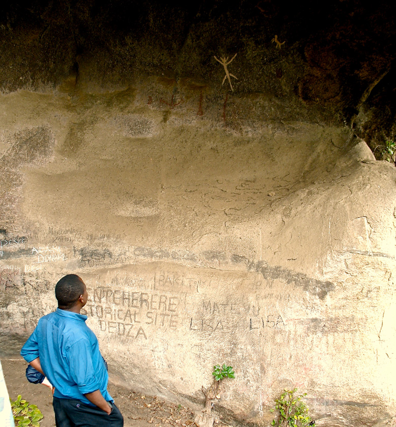
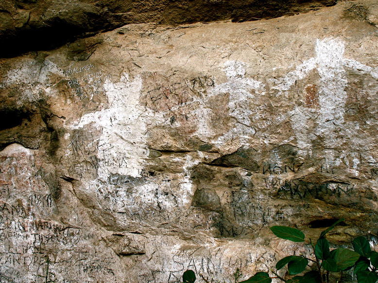
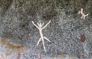
We move cautiously around a cliff face and to just to our right a cave looms about 50 feet above us. To our amazement we see them clearly on the ceiling. White images. Clearly markings made by man. Images of human beings and animals. A crocodile drawn on the ceiling while off to its right is some specie a monkey of some type. The group grows quiet, and the Malawian guides stand quietly as everyone seems to realize people hundreds of years ago recorded their lives, their knowledge and their history at this very spot.
Near the bottom of the rock well below the drawings, graffiti from recent intrusions desecrate the importance of this place. It is both amazing and sad that such an important piece of the history of a people, lost in the annals of history, can be so insulted. The students now realize how important we consider this find so their excitement increases as they lead us to a second cave where images of what appears to be adult and child drawings are equally evident.
In this second location silence surrounds us again as we realize we are looking directly into the past of a people who disappeared without any record of their departure or the reason it occurred so suddenly.
Who were the people who lived in this cave? What was the significance of what appears to be a crocodile wall painting when rivers and lakes containing them, at least today, are hundreds of miles away? Was this a crock, as we know them today, or was it some sort of giant land creature? Why was a monkey looking creature drawn near by? Were these animals the source of food, or were they in some way revered or worshipped? This hidden mountain top contains no brochure rack of literature to give the visitor an explanation for the drawings, nor do the students or teacher have clarification for our questions. The mystery will remain locked away for explanation another day from some other source.
Views Are More Spectacular
Coming down the mountain the view to the south and southwest seems even more spectacular. The schoolboys are visibly excited to be escorts to the Americans, and seems to grow as the group descends toward the school. Perhaps their classmates will now appeal to their great knowledge of what the Azungu (white faces) are like. After all, most of the children in the school have no first hand experience of ever having been with Europeans or Americans.
Reaching the school we offer a few Kwacha to each of the children for their assistance, and take note of the teacher’s request for schoolbooks, pencils and paper and his students. Perhaps one day we can return to the school with a vehicle full of supplies, a reward for their assistance to see a piece of the past. With some sadness we climb into the vehicle, and retrace our route to the Dedza Trading Center. At that juncture we turn south on M-1 to begin a route we have been told is a new road that crosses the mountains toward the big lake. We cannot confirm this to be fact even with those we have met here in Dedza, but we will soon find out if it is true, or if we will find ourselves on impassable roads in improbable places as we “Travel Malawi.”
For more information on the Chongoni Rock Art are of Malawi go to: https://en.wikipedia.org/wiki/Chongoni_Rock_Art_Area or
http://whc.unesco.org/en/list/476


